Complete List Of Adamawa State Postal Codes
This is the list of Adamawa State zip codes In 2023, Including Jimeta, Yola, Mubi, Yola South, and Girei postal codes. Adamawa State is split into twenty-one Local Government Areas (LGAs) with postal codes that vary from 640001 to 652109.
In this post, I will provide a complete list of Adamawa State postcodes including all the 21 LGAs, plus their zip codes. Let’s learn.
SEE ALSO: Zamfara State Postal Code
Run-Through Of Adamawa State
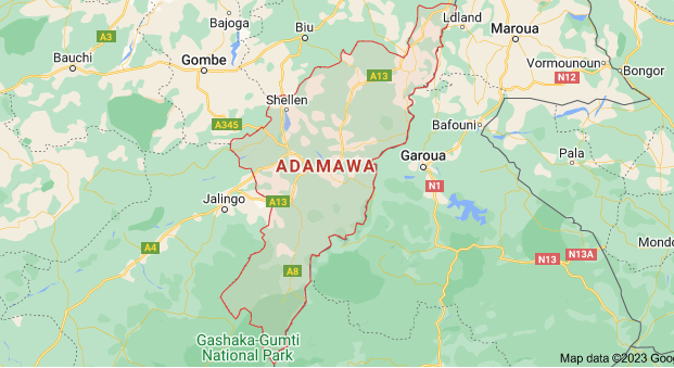
Adamawa State, also known as Leydi Adamaawa, is in the northeastern part of Nigeria. Adamawa State is incredibly diverse, with over 100 different ethnic groups living there. It became its state in 1991 when it separated from Gongola State.
In terms of size, it’s the eighth-largest state in Nigeria, but it’s not very densely populated, with around 4.25 million people in 2016. The geography of Adamawa includes mountains, plateaus, valleys, and rivers like the Benue and Gongola.
It has both savanna and forested areas, and in the south, you can find the Gashaka Gumti National Park, a cottage to various wildlife species.
Historically, the area was part of the Fulani Emirate during the 1800s, but it later came under German and British control.
After World War I, the British section became a region of Nigeria, while the German-controlled part joined Cameroon until a referendum in 1961. Adamawa State has a lot of land that’s great for farming, beautiful waterfalls, and varied landscapes.
It also has valuable minerals like limestone, tantalite, and kaolin. The state’s economy, which is like the money it makes, is estimated to be around ₦2.66 trillion, making it the 18th biggest economy among Nigeria’s 36 states and the largest in the Northeast region.
SEE ALSO: Kebbi State Postal Code
In 2021, the state’s total income grew by 9.93%, reaching ₦777.62 billion. However, Adamawa receives a lot of money from the federal government, with 77.52% of its income coming from there in 2021.
The state also made ₦8.65 billion on its own from things like taxes in 2021. It imported goods worth $25.02 million between 2019 and 2021, and it has a debt of ₦132.68 billion as of December 2021, ranking it as the 19th most indebted state in Nigeria and the 2nd most indebted in the Northeast.
The Dangote group, which is a big company, runs a sugar factory in Numan. This factory can refine 3,000 tons of sugarcane every day. They plan to make it even bigger, going up to 6,000, 9,800, and 15,000 tons per day.
Also, they want to expand the size of the factory from 8,700 hectares in 2022 to about 24,200 hectares in seven years. The markets in Adamawa State are essential for its economy and the people who live there.
These markets, especially the ones for cattle, have helped the state grow economically. People grow crops like groundnuts and beans for sale, and they also grow rice, maize, and sorghum for food.
Near the River Yedseram and its tributaries, people do vegetable gardening in the dry season. Fishing is also popular in the areas around the river.
There are different types of cattle in Adamawa, like Adamawa Gudali, Sokoto Gudali, White Fulani, Ambala, Red Sokoto, and Red Fulani. The state has about 1.5 million cattle and 64 places where they can graze, with 30 of them being officially designated.
SEE ALSO: Kaduna State Postal Code
Adamawa State is known for its cattle industry, with 2.5 million cattle in Nigeria coming from there. People from all over Nigeria and West Africa come to buy and sell cattle in places like the Mubi International cattle market in Mubi South.
Despite having a lot of cattle, the markets don’t have the facilities needed to process meat properly. This means live animals have to be transported for four days in trucks before they reach cities with high demand in regions like the South-West, South-South, or South-East Nigeria.
Unfortunately, the Boko Haram insurgency has harmed the state’s development, but things have been improving since 2016.
Adamawa State Postal Codes By Address
| Postcode | Location | LGA |
|---|---|---|
| 640001 | GPO | Yola North |
| 640002 | Yola town | Yola South |
| 640107 | Fufore | Fufure |
| 641001 | Ganye | Ganye |
| 641002 | Mayo Belwa | Mayo Belwa |
| 641003 | Jada | Jada |
| 642001 | Numan | Numan |
| 642002 | Lamurde | Lamurde |
| 642004 | Demsa | Demsa |
| 642005 | Borrong | Demsa |
| 643001 | Guyuk | Guyuk |
| 643002 | Shelleng | Shelleng |
| 650001 | Mubi | Mubi South |
| 650002 | Hong | Hong |
| 652001 | Gombi | Gombi |
| 652001 | Dumne | Song |
| 652005 | FUT | Girei |
Adamawa State Postal Codes By LGA
| Street | Postcode |
|---|---|
| Demsa | 642102 - 642110 |
| Fufore | 640103 - 640109 |
| Ganye | 641110 - 642116 |
| Girei | 652105 |
| Gombi | 652101 - 652109 |
| Guyuk | 643101 - 643112 |
| Hong | 650107 - 650111 |
| Jada | 641107 - 641127 |
| Lamurde | 642104 - 642117 |
| Madagali | 651102 - 651113 |
| Maiha | 650104 - 650115 |
| Mayo Belwa | 641101 - 642121 |
| Michika | 651103 - 657101 |
| Mubi North | 650101 - 650113 |
| Numan | 642101 - 643121 |
| Shelleng | 643102 |
| Song | 652102 - 652107 |
| Toungo | 641106 - 641119 |
| Yola North * | 640211 - 640284 |
| Yola South | 640101 - 640102 |
Adamawa State Post Office Locations
Find a list of the available post offices in Adamawa State and where they are located.
Office | Address | City | LGA |
|---|---|---|---|
Borrong | Angwan Yungun, Borrong | Borroni | Demsa |
Demsa | Yola - Numan Road | Demsa | Demsa |
Fed Sec Yola | Yola Road | Jimeta | Yola North |
Fufore | Gurin Road | Fufore | Fufore |
FUT Yola | Mubi Road | Girei | Girei |
Ganye | Tappare Road | Ganye | Ganye |
Garkida | Hospital road Garkida | Garkida | Gombi |
Gombi | Biu Road, Gombi | Gombi | Gombi |
Guyuk | Bank Road, Guyuk | Guyuk | Guyuk |
Hong | Opposite Cottage Hospital, Hong | Hong | Hong |
Jada | Ganya Road | Jada | Jada |
Lafia-Lamurde | Numan- Gombe Road | Lafia-Lamurde | Lamurde |
Mayo Belwa | Zing Road | Mayo Belwa | Mayo Belwa |
Michika | Bama road Michika Town | Michika | Michika |
Mubi | Ahmadu Bello Way Mubi | Mubi | Mubi North |
Numan | Gombe Road | Numan | Numan |
Shelleng | Township Road | Shelleng | Shelleng |
Song | Mubi Road | Song | Song |
State Sec Yola | Yola Road | Jimeta | Yola North |
Uba | Michika road | Uba | Hong |
Yola G P O | 24 Ahmadu Bello Way Yola | Yola | Yola North |
Yola Town | Sokoto Street | Yola Town | Yola South |
SEE ALSO: Postal Codes Of All States In Nigeria
FAQ
● Which LGA Is The Most Populated In Adamawa State?
The most populated Local Government Area (LGA) in Adamawa State is Michika. It’s where you’ll find the largest number of people living in the state.
● How Many Local Government Areas Are There In Adamawa?
Adamawa State is divided into 21 Local Government Areas (LGAs). These LGAs are Demsa, Fufore, Ganye, Girei, Gombi, Guyuk, Hong, Jada, Lamurde, Madagali, Maiha, Mayo-Belwa, Michika, Mubi North, Mubi South, Numan, Shelleng, Song, Toungo, Yola North, and Yola South.